 |
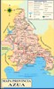
Azua de Compostela, the full name of the city, is the capital of the province Azua. The surface of the province is 2.531,77 km˛ and is the sixth largest of 31 provinces.
The city has about 128.264 inhabitants (2012), 92.585 urban and 35.679 rural. The province counts 256.981 residents (2012), number 13 on the list of 31 provinces, 139.512 urban and 117.469 rural, population density: 101 inhabitants to the km˛.
.
Azua is a province of the Dominican Republic in the south of the country. In the north she is bordered by the provinces San Juan and La Vega, in the south by the Caribbean sea, in the east by the provinces La Vega, San José de Ocoa and Peravia, and in the west by the provinces San Juan, Bahoruco and Barahona. She is divided in 10 municipalities and 22 municipal districts.
The province has four deputies in the Chamber of Deputies (Lower House) and one senator in the Senate (Upper House).
The province is formed by a littoral low-lying plain, which end in a horseshoe-shaped bay, the bay of Ocoa, surrounded by mountain reliefs belonging to the Central mountain range, where you can find the mountains El Muńeco, 1711 m., Monte Culo de Maco, 2189 m., Loma Alto de Santa Rosa, 1734 m., Loma Atanasio, 1591 m., Firme de Pajón Blanco, 2240 m., Loma Sabana Abajo, 1509 m., and Loma Piquito, 1770 m. high. The mountain range Martín García is the natural border between Azua and Barahona, and begins at La Punta Martín García. Here you can find the mountains El Busú, 980 m., Loma del Curro, 1343 m. and Loma Fría, 1285 m. high.
There are two national parks, José del Carmen Ramírez and Sierra Martín García. Another protected area is Valle Nuevo.
The province, with forest in the north and thanks to irrigation agriculture in the south, has a port to the Caribbean sea. Her economy is based on the coffee plantation, sugar-cane and tabacco, and other cultivations of grain, nurseries, rice, maize, bananas, carrots and vegetables. Fishing is an important business too.
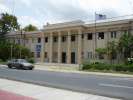
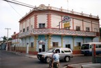
Azua de Compostela is a little urban and commercial centre. The climate is hot and dry (26°C and 630 mm). It's a communication-centre. It's located 97 km southeast of the Dominican capital. It's bordered by the hill Resolí in the north, the Cańada de la Vaca in the south, the Lot 664-B in the east and the river Las Yayitas in the west. Azua is located at an altitude of 88 meters above sea level.
Production:
27,3% of the total surface of the municipality Azua is exploited agriculturally. The majority of the farmers has (too) small farmland. They use primitive tools like the handplough, oxes, the aks and the machete. This group of the population lives in an economy of surviving.
Although the bigger part of the municipal ground is divided in medium size land. Here they use a combination of hand, but mostly mechanised tools. The large lots of more than 800 tareas (one tarea = 620,83 m˛), are owned by a few big producers.
The municipality of Azua is one of the most fortunate because of the installation of agraric industrial factories, protected by the Law 409, which stimulated the development of the public and private financial sector. Azua has a population of 23.242 people that can be economically active. The working class however consists of 16.167 people (that's 69%). Within this working class there are 3.232 civil servants (20%).
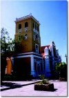
The city was founded in 1504 by the Spaniards.
The 19th of march 1844 is a historical date in Azua, that's why they give this name to
buildings and parks. At that day the independence, under the national guidance of Duarte, reached Azua too, thanks to a victory in some battles with artillery and two cannons.
When you want to know a little bit more about the history of Azua, click here.
Click here for more maps of Azua and the environment.
|